







| WEATHER STORY Rapid City Weather Forecast Office |
|
|
|
|
|
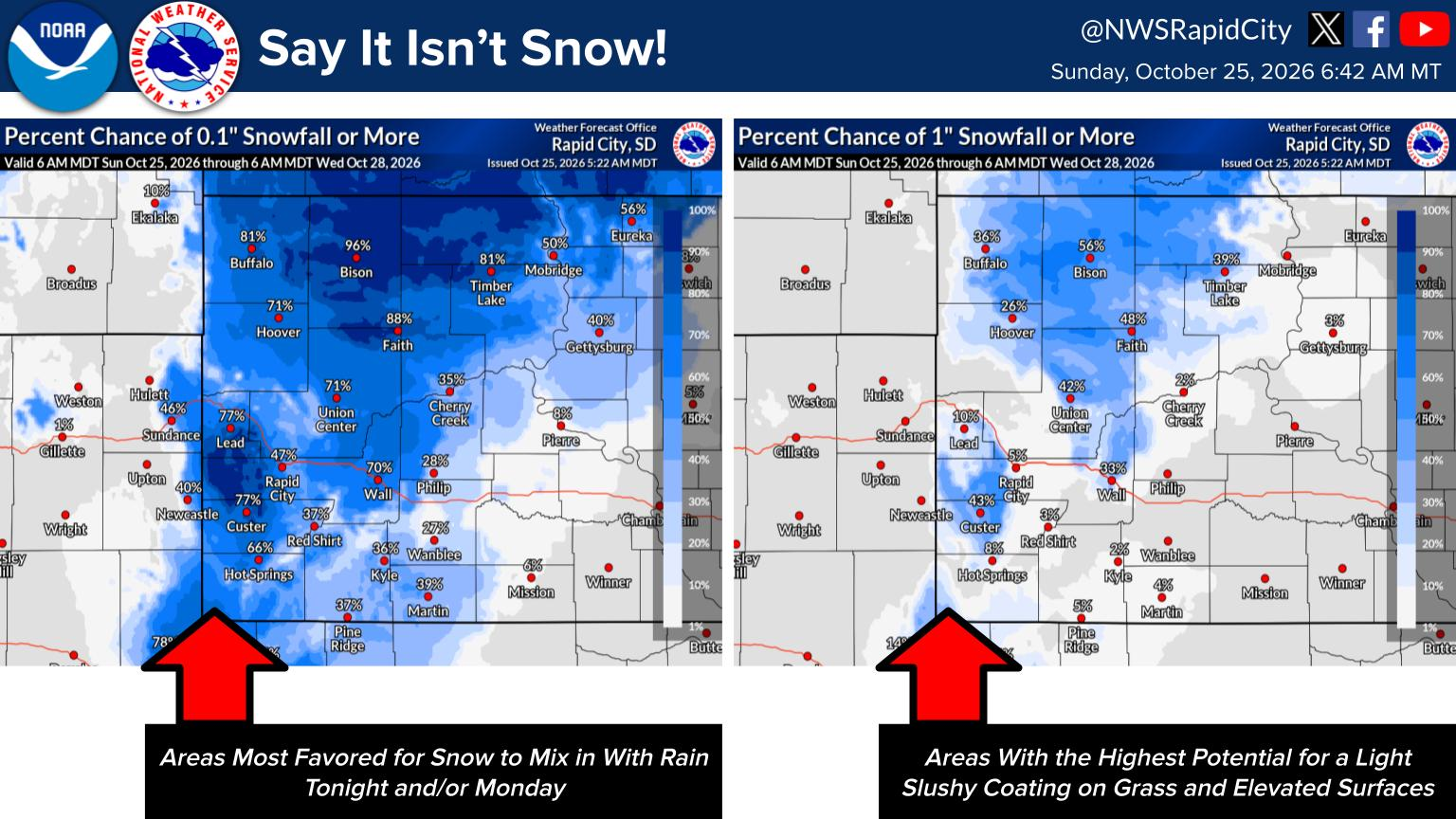
A persistent upper-level trough settling over the Northern Plains will bring a stretch of chilly and unsettled weather to western South Dakota and northeastern Wyoming through early next week. Low temperatures tonight will fall into the 30s to lower 40s, with precipitation chances increasing late from south to north, bringing a potential mix of rain and higher-elevation snow showers.
Below-normal temperatures will continue through Monday. Highs on Sunday will range from the lower 40s to lower 50s alongside scattered rain showers, while Monday will remain raw and brisk with highs of 35°F to 50°F and scattered rain/snow showers. Conditions begin to dry out and moderate on Tuesday as winds turn breezy and daytime highs climb back into the upper 50s to mid-60s.
|
Select a Different Office Below
Data Courtesy of Rapid City Weather Forecast Office